 Special Unified Marking Schemes (SUMS)
 Special Unified Marking Schemes (SUMS) allows aquaculture operators mark out the boundaries of their licences site in accordance with the requirements of their aquaculture licence in a unified scheme. BIM works with aquaculture operators in this area and there are currently 17 SUMS schemes in bays around the coast with approximately 300 marks installed. New SUMS are being added regularly and existing one are maintained on an ongoing basis.
Primarily a safety scheme to aid navigation, this brings together adjacent aquaculture operators to establish the most efficient system for marking their sites. SUMS are group marking schemes for aquaculture sites that are used in bays or inshore areas where there is more than one aquaculture operation; that is the establishment of a SUMS will only be considered where there are clusters of sites and where the SUMS approach makes more navigational sense than having each site individually lit.
All SUMS must be planned and deployed with the full approval and prior knowledge of the Commissioner of Irish Lights and the Marine Survey Office. As all aquaculture marine sites are required to have their sites marked, these schemes facilitate the producers in that a reduced number of markers are required per area, which in turn reduce the cost of maintenance. Fewer markers have a reduced visual impact, are less confusing to other marine users in the marked area and assist with navigation.
BIM assisted oyster farmers in Dungarvan Harbour to incorporate their sites’ boundary marks into one enhanced marking scheme for the production area to provide an effective visual guide for those navigating the harbour.
Improved navigation and safety for all users. Previously each oyster farm in the harbour had its own marks indicating the boundaries of the site. These numerous site markings made navigation of the harbour difficult. Unifying the sites under one marking scheme had the dual advantage of improving navigation of the harbour and providing efficiencies for the fish farmers.
 |
Visually ineffective in all weather and tides. The poles made navigation of the bay difficult.
 |
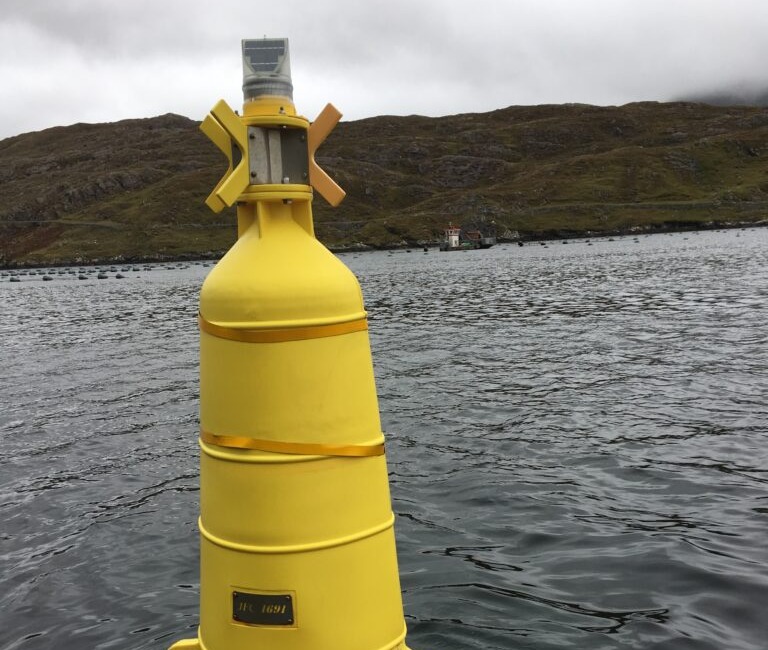
The new markings clearly indicate the perimeter of the production area and work across all tides and weather.
BIM’s Regional Resource officer and the local oyster producers worked together to design a draft unified marking scheme for the sites.
This involved:
Once the design was approved:
 |
Improved navigation and safety of the harbour
Building on the success of this project we are currently installing innovative unified marking schemes in other bays and harbours.
